


Hadern


Historical Background of Hadern
Hadern was first mentioned in the 11th century as “Haderun” and was originally a farming village. In 1938, it was incorporated into Munich, making it one of the city’s youngest districts. Particularly after World War II, numerous large housing developments were built here until the 1980s, including Blumenau and Kleinhadern, on formerly agricultural land.
Hadern today
The district of Hadern is located in the southwestern part of Munich and consists of three sub-districts: Blumenau, Neuhadern, and Großhadern. The Waldfriedhof in the south is Munich’s largest cemetery, covering over 170 hectares. The Klinikum Großhadern, a large hospital complex of the Ludwig Maximilian University, is a prominent feature of the district. Hadern is well-connected to public transportation with the extension of U-Bahn line 6 and offers numerous social facilities.
Building structure
In the southern half of Hadern, single-family homes and villa neighborhoods dominate, making it one of the most desirable residential areas. In recent years, new construction projects have been carried out, such as south of the hospital, including over 93 new condominiums built in 2011. The development of new residential buildings continues.
.
Population
The district of Hadern has 47,949 inhabitants, resulting in a population density of 52 people per hectare. The population is particularly characterized by highly qualified workers and seniors (over 65 years old). The proportion of foreign nationals is 22.8%, which is below the Munich average. Two-thirds of the employed population work as employees or civil servants.
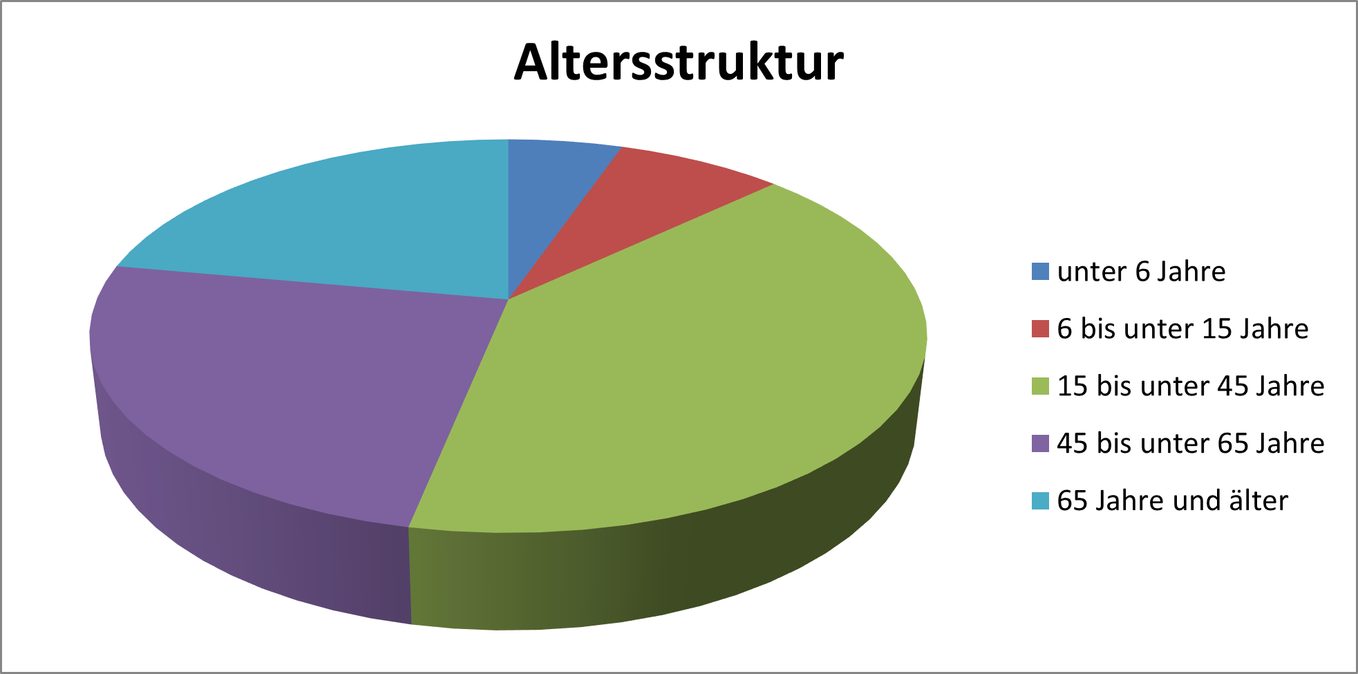
Age structure in Hadern
The largest age group in Hadern is between 15 and 45 years old. However, it is noticeable that nearly half of the population is over 45 years old, making the district attractive to all age groups.
.
Age structure in Hadern
Numbers and Facts
-
Area: 923.29 hectares
-
Population: 47,949
-
Population density: 52 people per hectare
-
Proportion of foreign nationals: 22.8%