


Ramersdorf-Perlach


Location
Ramersdorf-Perlach is located in the southeast of Munich and is the city’s 16th district. It borders Au-Haidhausen and Berg am Laim to the north, Trudering-Riem to the east, and Neubiberg in the Munich district to the south. Its central location provides excellent connections to the city center as well as to the surrounding regions. Road access and proximity to the Mittlerer Ring and the A8 motorway ensure quick and easy travel to many destinations both within and outside of Munich.
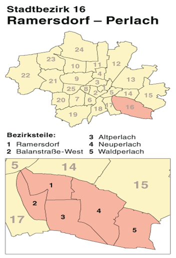
Subdivision of Ramersdorf-Perlach
History
Ramersdorf was first mentioned in official records between 1006 and 1022 under the name “Rumoltesdorf.” Perlach was already known around the year 790 as “peralohc” and was incorporated into Munich in 1930. Starting in 1967, Neuperlach was developed as a satellite city to accommodate Munich’s growing population. Over the years, the district has transformed from a rural center into a modern urban area that blends both historical and contemporary elements.
Building structure
The architecture in Ramersdorf-Perlach is diverse and reflects the district’s development over time. Ramersdorf still features many historic buildings, including the pilgrimage church Maria Ramersdorf. However, the area has evolved into a densely built residential and commercial district. In particular, Neuperlach is characterized by large housing complexes that were constructed in the 1960s as part of an urban development project. The district also boasts a high number of green spaces and sports facilities, contributing to a high quality of life.
Population Structure
Ramersdorf-Perlach has a population of around 107,000 residents. The district is characterized by a high number of people aged 15 to 45, making it especially attractive to young families and commuters. The proportion of foreign nationals is approximately 29.7%, highlighting the district’s multicultural character. Natural population growth shows a surplus of births, while migration trends indicate a positive net increase of 1,468 residents.
Land Use and Commercial Activity
Ramersdorf-Perlach covers an area of 1,988.07 hectares. The majority of this area—around 51.1%—is used for residential buildings and their surrounding open spaces. In addition, a significant portion (13.2%) consists of green spaces dedicated to recreation and leisure. The district has a relatively small industrial footprint, with 8.4% of the land used for commercial purposes, primarily by small and medium-sized enterprises.
Infrastructure and Connectivity
The infrastructure of Ramersdorf-Perlach is exceptionally well developed. The district has excellent connections to Munich’s transportation network, both by public transport and by car. The Mittlerer Ring and the A8 motorway provide fast access to destinations within Munich as well as to surrounding cities and districts. Local amenities such as shops, restaurants, and leisure facilities are also well provided for in the area.
Conclusion
Ramersdorf-Perlach combines history and modernity while offering a high quality of life. Over the years, the district has undergone significant development and now provides a well-balanced mix of residential areas, commercial zones, and green spaces. Particularly noteworthy are the excellent transport connections and the wide range of leisure opportunities, which make the district an attractive place to live.