Schwabing – Freimann
historical background of Schwabing – Freimann
Schwabing was first mentioned in historical records in 782 under the name “Suuapinga.” This name derives from “Swapo” and roughly means “settlement of a Swabian.” In the 17th and 18th centuries, the area was mainly inhabited by fishermen and dairy farmers. In 1886, the former village of Schwabing was elevated to town status and was incorporated into Munich just four years later. By 1909, Schwabing’s residential areas had already been divided into the districts of Schwabing-West and Schwabing. In 1996, the district was expanded to include northern Schwabing with the hospital and Luitpold Park, as well as the southeastern part of the Oberwiesenfeld area. This expansion tripled the district’s area and consequently doubled its population.
At the end of the 19th century, the neighborhood became known for its writers and artists, earning a reputation as an artists’ quarter. Among those who gathered there were the painters of the “Blue Rider” group, including Wassily Kandinsky, Franz Marc, and Paul Klee. One of the prominent literary figures was Thomas Mann. In addition to these well-known names, the cultural magazine Die Jugend was also published there, which gave the Jugendstil (Art Nouveau) movement its name.
Location
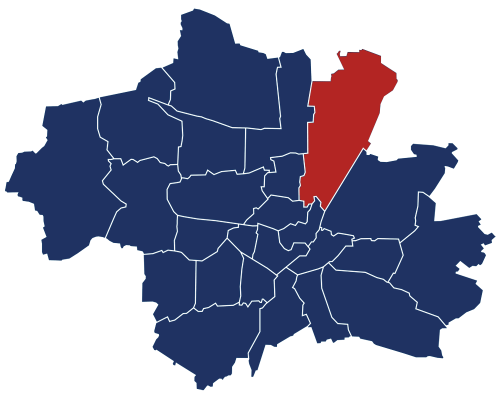
District 4: Schwabing-West is located right in the heart of Munich. It is bordered by the district of Schwabing-Freimann to the west, Maxvorstadt to the south, and Neuhausen-Nymphenburg. It also borders Milbertshofen-Am Hart, which lies to the north but also partially forms the northwestern boundary of Schwabing-West. Schwabing-West itself can be further divided into its eight sub-districts: 4.1 Neuschwabing, 4.2 Am Luitpoldpark, 4.3 Schwere-Reiter-Straße.
Building structure
Characteristic of this district are the square structures of Elisabethplatz, Kurfürstenplatz, and Hohenzollernplatz, which were already laid out during the Gründerzeit city planning and serve important and central functions for the neighborhood. The area is mainly characterized by dense, cohesive residential buildings, including well-preserved historic structures and infill buildings constructed between the 1950s and 1970s.
The district’s new urban quarter, “Am Ackermannbogen,” is located between the Gründerzeit-era Schwabing and the Olympiapark, on a former military barracks site. It includes a total of 2,250 residential units and 500 workplaces. The quarter is interwoven with generous green spaces, such as the “Große Wiese” and the urban forest (Stadtwald).
Other notable buildings and developed areas in this district include the Schwabing Hospital in the north (one of the largest hospitals in Munich), the Max Planck Institute of Psychiatry, the Rehabilitation Center for the Physically Disabled (Pfennigparade Foundation), and a senior residence (München Stift GmbH).
To the west, the Luitpoldpark—established in 1912—together with the Georgenschwaig pool and the greened rubble hill (Schuttberg), form a contiguous 26-hectare recreational area. For the future, there are plans to create approximately 1,000 housing units on the decommissioned military site of the former Luitpold barracks.
Population
A total of 64,768 residents currently live in the district of Schwabing-West. Due to its small area of 436.30 hectares, the population density is 148 residents per hectare—the highest in all of Munich. The proportion of foreign nationals is 20.8%, which is below the citywide average. However, people of working age are overrepresented compared to the overall city average.
The local workforce is predominantly employed in public institutions and administrative services. One- or two-person households of younger and middle age groups are especially common, while families with children are particularly well represented in the new residential area “Am Ackermannbogen.”
In addition, the district is experiencing continuous population growth. This is most evident in migration figures, which show a net gain of +1,749 people, and in natural population development, with a birth surplus of +205.
age structure in Schwabing – Freimann
The “15 to under 45-year-olds” represent the largest age group, totaling 32,233 residents, which accounts for 49.77% of the population.

age structure of Schwabing – Freimann
This indicates that there is a large target group for RE/MAX, as nearly 50% of the residents are in the age range where people typically consider buying or renting a home, or are frequently planning to move and have sufficient financial means to do so.
Numbers and Facts
- area: 436.30 hectares
- population: 64,768 residents
- population density: 148 residents per hectare


