


Sendling-Westpark


Historical Background of Sendling-Westpark
The district of Sendling-Westpark was created in 1992 through a reorganization of Munich’s city districts; prior to that, the area was part of the Sendling district. The new district was named after Westpark, a vast green space that was created in 1983 for the International Garden Exhibition.
Location
Sendling-Westpark is located in the southwest of Munich, north of Laim and Schwanthalerhöhe. The district stretches from Hadern in the west to Sendling in the east. It is divided into three district parts: Mittersendling, Land in Sonne, and Am Waldfriedhof.
Building structure
The development of Sendling-Westpark began in the 1920s with the Kriegersiedlung, a settlement for veterans of World War I. Later, single-family homes and multi-story residential buildings were constructed. The large project “Tunnel Süd-West” aims to improve air quality and reduce noise. Westpark is a large recreational area with attractions such as the lakeside stage and the Thai pagoda. The district also includes parts of the Sendlinger Forest, the “Land in Sonne” allotment garden, and various public facilities, including the Audi Dome.
Population
The district has 54,552 inhabitants and an area of 781.45 hectares, resulting in a population density of 70 residents per hectare. The proportion of foreign nationals is 25.4%. The district experienced a population increase of 2,112 people between 1995 and 2020, primarily due to migration.
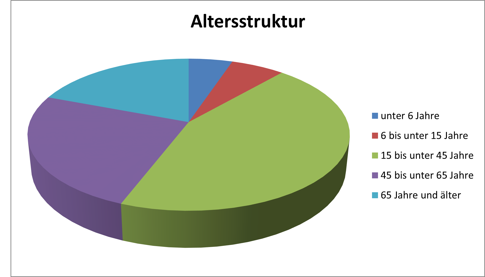
Age Structure in Sendling-Westpark
The largest age group in the district is the 15 to 45-year-olds, with 24,221 people (44.4% of the population). This makes the district particularly attractive for RE/MAX, as many people in this age group are looking for homes.
Age Structure in Sendling-Westpark
Numbers and Facts
- Area: 781.45 hectares
- Population: 54,552
- Population density: 70 residents per hectare